


How to look up your own lake's health rating and what's been funded in your town — at the bottom of this story.
The state has released two five-year cleanup plans covering most of northwestern Vermont, with public comment open through Oct. 29. Inside both, the Department of Environmental Conservation writes that it does not expect to meet its next phosphorus reduction target for runoff from roads and developed land, and is considering making up the difference in other sectors.
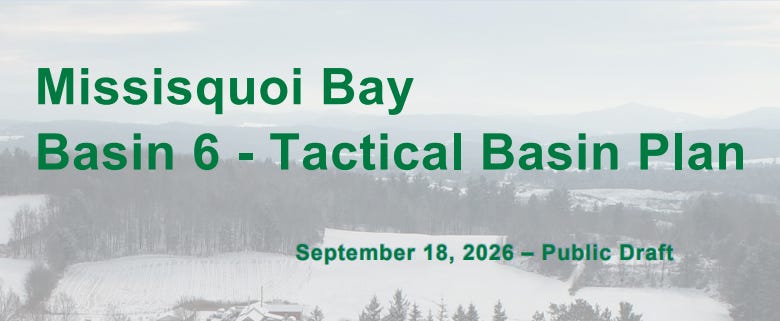
The Missisquoi Bay plan covers 24 towns from Swanton to Lowell. The Lamoille River plan runs from Greensboro to Milton, covering 34. Both are dated Sept. 18.
“Public participation is critical to the success of each tactical basin plan, helping us to advance Vermont’s clean water goals in ways that are also responsive to local needs,” DEC Commissioner Misty Sinsigalli said in announcing the drafts.
Phosphorus is the nutrient that feeds the blue-green algae blooms that close Vermont beaches in late summer; some of those cyanobacteria produce toxins, which is why the state posts advisories. Since 2016, a federal cleanup order — a “total maximum daily load,” or TMDL, essentially a pollution budget — has required roughly a one-third cut in the phosphorus reaching Lake Champlain from Vermont’s share of the watershed by 2036.
A quarter of the way, with more than half the clock gone
The Missisquoi plan’s reduction target totals 100,429 kilograms of phosphorus a year; the Lamoille’s, 17,234. As of state fiscal year 2025, Missisquoi reports achieving about 25 percent and the Lamoille about 26 percent. Excluding rivers, which both plans expect to take decades longer, the figures are 36 and 32 percent.
Ten of the twenty years are gone.
A caveat belongs on every number in these plans: they are estimates of what projects should accomplish, calculated from modeled pollutant loads and expected efficiency rates, not measurements taken in the bay. They also mix reporting years — farm data runs through fiscal 2024 because 2025 reporting was incomplete, other sectors through 2025.
Agriculture carries most of it in Missisquoi. Fields and pastures face an 82.8 percent reduction, the steepest demand in either plan, and were at about 45 percent of target as of fiscal 2024.
Lamoille’s forests are past their number. Estimated reductions there have exceeded the sector’s numerical target since 2018, reaching 144 percent.
Runoff lags in both. Developed-land work sits at about 7 percent of target in Missisquoi and, for stormwater specifically, 7.7 percent in the Lamoille, though Lamoille roads are further along at 23.3 percent.
That last category is not only a municipal obligation. It covers state highways owned by VTrans, municipal roads, regulated storm sewer systems, and private sites with three or more acres of impervious surface.
The sentence in both plans
Against a five-year target set in 2021, Missisquoi’s developed-land projects had delivered 522 kilograms a year — 20 percent of a 2,562-kilogram goal set for fiscal 2026. The Lamoille’s had delivered 697 of 1,650, or 42 percent. Both figures stop at fiscal 2025, a year short of the target year.
The plans say those figures may understate the work. DEC tracks grant-funded road upgrades but relies on towns to report work they fund themselves, and the Missisquoi draft warns “the Agency expects this could lead to its undercounting of phosphorous reductions.” It flags a second undercount: the credit for a road fix is an average across road slopes, and the next round of inventories targets steeper roads, where real reductions “may be higher than the previously assumed average.”
Then both plans say the same thing about what comes next. From the Missisquoi draft:
“Measured phosphorus reductions did not meet the recent five-year target. While the Agency believes that existing or new programs provide opportunities to increase phosphorous reduction trends, it does not expect to meet the next five-year target either. ... the Agency is considering opportunities to realize greater reductions in other sectors that will address the shortfall in Basin 6’s developed lands sector.”
The Lamoille plan says the same of its own non-regulatory developed-land projects.
Neither plan says which sectors would absorb the difference. In Missisquoi, agriculture is the largest, at roughly half the basin’s reduction target.
One clause there does not match the plan’s own table. The draft calls developed land “only 15%” of the basin’s overall reduction target, but Table 11 assigns the sector 7,371 kilograms of a 100,429-kilogram total — about 7.3 percent. The plan does not reconcile the two figures.
What EPA said fifteen months ago
A report card dated June 17, 2025, signed by Ken Moraff as director of the Water Division at EPA’s New England office, reviewed four basins including these two.
EPA found reductions across Vermont’s portion of the Lake Champlain watershed had grown from 12.5 metric tons a year in 2016 to 54.7 in 2024 — 26 percent of the 212.4 metric tons required. Then:
“the pace of reductions must increase from a current average of 5.275 metric tons to 12.13 metric tons per year in the future to stay on track to meet required phosphorus reductions by 2036.”
“without an increase in the pace of reductions, we remain concerned that phosphorus goals will not be achieved in the timeline in the Lake Champlain TMDL.”
That assessment rested on the estimates available then, and those estimates move. Vermont’s Clean Water Initiative 2025 Performance Report now puts the Lake Champlain basin at 35 percent, up from 26 a year earlier. It attributes such revisions partly to reporting lag — data collection “necessarily introduces a lag,” later years fill in earlier ones, an effect “akin to the true-ups seen in Federal economic indicator reporting and is not indicative of a shifting trend in progress” — and partly to accounting changes, including a 2021 switch to reporting phosphorus as delivered load rather than load at the source. Compass examined the counting behind that report in January.
How these basins compare
By EPA’s 2025 figures, Missisquoi sits toward the top of the large basins and the Lamoille nearer the bottom: Northern Lake Champlain 30.5 percent, Missisquoi 24, Otter Creek 17, Lamoille 15, and Winooski 14 on a report card final for that planning cycle. EPA credited Missisquoi with doubling its progress from 12 percent. Because those reviews were conducted in different years, the ranking is rough.
EPA also concluded Vermont is “on track to satisfactorily complete the five-year actions” in both plans — a judgment about whether the state is doing what it said it would. Its finding that reductions are running at less than half the required rate was a broader assessment across Vermont’s Lake Champlain basins, not a rate calculated for these two.
Why this reaches your town
Under the Municipal Roads General Permit, towns must inventory road segments where runoff drains to a stream and upgrade at least 7.5 percent of non-compliant segments a year. A full reassessment is due in the fall of 2027; once it is complete, 20 percent of segments rated “very high priority” must be upgraded annually as part of that same 7.5 percent, not on top of it. All of it must be done by Dec. 31, 2036 — the same deadline as the lake. VTrans reimburses up to 80 percent of documented construction costs through its Municipal Grants-in-Aid program.
The Missisquoi plan names one town, Bakersfield, as possibly needing its recorded work updated in the state’s drainage map or benefiting from additional drainage-upgrade support.
There is improvement to point to. Lake Carmi in Franklin — designated in 2018 as the state’s only “lake in crisis” under 10 V.S.A. § 1310 — received an aluminum sulfate treatment last fall that binds phosphorus in the sediment. The plan reports $5.5 million invested there through fiscal 2025 and, through fiscal 2024, reductions of more than 1,600 kilograms a year, roughly 99 percent from farms changing practices; Compass reported record spring clarity after the treatment. The Lake Champlain Basin Program’s 2024 State of the Lake found Missisquoi Bay’s 2023 phosphorus level its lowest since 1994, while noting no segment has stayed consistently below its limit since 1990.
Both plans also leave one thing blank. The Missisquoi draft reads: “The 2021 Basin Plan identified 43 strategies to protect and restore surface waters. Of X of these are complete,” with a footnote that the report card “was not completed by the date of this draft.” The Lamoille plan carries the same blank against its 63 strategies.
Check your own water
Your lake’s health rating. DEC’s Lake Score Card rates 823 Vermont lakes on nutrients, invasive species, shoreland condition and mercury.
What’s been funded in your town. The Clean Water Project Explorer filters state-funded water projects by town and basin back to 2016, and exports to a spreadsheet.
Before you swim. The Vermont cyanobacteria tracker posts conditions at monitored beaches. Observations are collected weekly, not in real time, and as the Health Department warns, “Not all Vermont bays, lakes, and ponds are monitored.”
Your town’s road work. Road erosion inventory results by town appear in DEC’s MRGP Implementation Table and its Drainage Infrastructure Resource Tool map, linked from the Municipal Roads Program page.
To comment. Through Oct. 29, to Karen Bates, Watershed Planner, at Karen.Bates@vermont.gov or 802-490-6144. The Lamoille meeting is Sept. 22 at 6:30 p.m. at the Lamoille County Regional Planning Commission, 52 Portland St., second floor, Morristown; DEC asks in-person attendees to register by emailing Bates. The Missisquoi meeting is Sept. 30 at 6:30 p.m. at the Northwest Regional Planning Commission, 75 Fairfield St., St. Albans. Zoom links are on the Basin 6 and Basin 7 pages.