

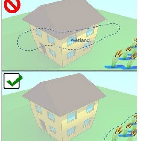
Say you own 40 acres in Vermont. Some of it is pasture, some is woods, and there’s a low spot down by the brook that holds water in the spring and dries out by August. You have never thought about it much.
This month the state finished redrawing its official map of Vermont’s wetlands, and that low spot may now be a shaded shape on a government website. The Department of Environmental Conservation announced the completion on its Facebook page in September. Within three days, scores of landowners had commented, most saying the same two things: nobody told me, and I don’t know what this means for my land.
The first is accurate, and there’s a rule behind it. The second has clearer answers than the comment thread suggests — but they are not the answers most people expect.
There is also a clock. Wetlands are identified on the ground during the growing season, roughly April through October, when the plants and soil conditions are readable.
A landowner who wants the state to come look this year has a few weeks. After that, the answer waits until spring.
Two different questions
Almost all the confusion comes from treating one question as two.
Is there a wetland on my land? That’s a fact about the ground — soil, plants, water.
Is it on the state’s map? That’s a fact about a database.
Those two answers do not have to match, and often don’t. Four situations exist:
On the map, and really there. The usual case. The wetland is regulated. The map shows roughly where it sits, not where its edge is.
On the map, but not really there. Mapping errors happen. The land is treated as regulated wetland until the state agrees otherwise, and asking it to agree is on you.
Not on the map, but really there. Still regulated. DEC’s landowner guidance says studies have found that up to 39% of Vermont’s wetlands were not mapped at all. Narrowing that gap is what the four-year update was for; the state has not published a figure for how much of it closed.
Not on the map, and not there. You’re clear.
DEC’s own fact sheets name the types its method underrepresents: forested wetlands, wetlands along rivers and streams, and wetlands inside farmland.
So the map is a warning system, not a verdict. A shape on your parcel means ask. A blank parcel means nothing at all — and reading a blank map as permission is the most expensive mistake available right now. DEC states it plainly on its landowner page: the inventory maps should not be treated as a complete source for verifying a property’s status.
The only thing that answers the question is a person looking at the ground.
What actually triggers the rules
Wetlands on the map are protected. So are wetlands that were never drawn. Section 4.6 of the Vermont Wetland Rules has treated unmapped wetlands as protected Class II wetlands since 2010 if they meet any of these:
Larger than half an acre, or the same type and size as wetlands already mapped
Thick non-woody plants or mostly woody plants, next to a stream, river or open water, and bigger than 2,500 square feet — about the footprint of a modest house
A vernal pool where amphibians breed
Above 2,500 feet in elevation and feeding a stream
Home to a rare, threatened, endangered or uncommon species
Protection extends 50 feet out from the wetland’s edge, roughly three car lengths.
Which means the September update did not put land under regulation that wasn’t under regulation before. It made visible some of what was already there — and that is how DEC describes it too. The basin fact sheets the department published alongside the new maps state directly that the update will not make more wetlands regulated under the Vermont Wetland Rules, and that the mapping instead lets the state and the public better identify wetlands that are already protected.
If you aren’t building anything
A shape on the map does not freeze your land, change your taxes or put anyone on your driveway. The rules list activities allowed in a wetland or its buffer with no permit:
Mowing and ordinary activities within an existing lawn
Repairing or replacing a building or structure already there, so long as you don’t expand it by more than 250 square feet
Hunting, fishing, hiking, skiing, snowshoeing, horseback riding, boating
Hand-pulling invasive Phragmites, the tall reed that takes over wet ground
Logging that follows the state’s accepted practices for water quality
Farming that follows the state’s required agricultural practices
Low-impact footpaths and trails that need no grading, fill or ditching
If your plan for the back forty is to keep doing what you’ve been doing, nothing about your life changed in September.
If you want to build
The map is not a boundary, and a permit application needs a boundary. Finding one is called a delineation — an on-site survey by a wetland scientist who reads the soil, the plants and the water and flags the actual edge. It has to be done in the growing season, and once a consultant produces one, DEC reviews it on site.
A delineation is good for five years. After that the boundary has to be looked at again.
If a wetland is in the way, a permit is possible but not automatic. DEC says plainly that the burden of proof sits with the applicant: you have to show the damage can’t be avoided, that you’ve minimized what’s left, and often that you’ll redesign. Staying outside the wetland and its 50-foot buffer is the fastest route to not needing a permit at all. And some properties can’t accommodate that. DEC is blunt on its landowner page — some land is not suitable for development, and the department has a name for parcels that are mostly or entirely wetland: swamp lots.
That sentence is the hard one in all of this, and it was as true in 2022 as it is today.
If you want to sell
The change here is real, and it isn’t the one people expect.
Vermont real estate transactions typically run through the Seller’s Property Information Report, the standardized form on which a seller describes known conditions of the property. Nothing about the new map changes what you know about your own land.
What it changes is what the other side can find. A buyer, a buyer’s attorney, a lender, a wastewater designer or a town zoning office can now enter your parcel number on a state website and see the state’s picture of your property in under a minute. For much of Vermont, that picture had been decades old and missing a great deal.
DEC warns on the same page that property owners may face fines and fees, or pursue civil damages against others involved in the purchase and build process — the builder, the agent, the designer. The department’s advice to everyone in a transaction is to check before money moves.
Who pays
This is the part the comment thread got closest to, and it comes down to a clean division. Finding out whether you have a problem is free. Doing anything about it is not.
Free:
Looking up your parcel on the state’s screening tool
Calling or emailing your District Wetland Ecologist with questions
Having that ecologist come out and walk the land. DEC’s published guidance calls this a free site visit and says the ecologist will tell you whether a wetland is present, whether it falls under the rules, whether you need to hire a consultant, and whether your project needs a permit. You request one with a Site Visit Request Form
Filing a petition to correct or remove a polygon you believe is wrong. DEC told the Legislature’s rules committee in January 2023 that there is no fee
You pay:
A delineation by a private consultant, which is what a permit application requires and what DEC says you will likely need for any project near a wetland or its buffer. The state publishes a consultant list but does not publish prices
The evidence behind a map-correction petition. The form is free, but it asks for photographs and notes from a wetland scientist, which is a consultant again
The wetland permit application fee itself
A landowner can find out where they stand without spending a dollar, and the free visit is also what tells you whether you need to spend anything at all. What a landowner cannot do without hiring somebody is build, sell with certainty, or get a map they believe is wrong corrected. The free help is diagnosis. Everything past diagnosis is on the owner.
How much free help exists is the open question. The Wetlands Program has a handful of review staff covering the entire state, and it has not published how many site visits it performs in a year, or how many map-correction petitions have been filed since that route opened in 2023. The growing season closes in a few weeks.
Why nobody sent you a letter
Vermont law has two ways to put a wetland under Class II protection, and they treat the landowner very differently.
The first is an individual determination under Section 8.1 of the rules. You get a registered letter. A 60-day window applies. You can appeal.
The second is a bulk map revision under Section 8.5(d), added to the rules in February 2023 and the route used for this update. Notice goes on the Environmental Notice Bulletin, the state’s online posting board for environmental actions. The rule says the notification requirements attached to individual determinations do not apply.
DEC did more than the minimum. It issued press releases in March and June of 2026, posted basin-by-basin notices naming every affected town, held public meetings around the state, and opened comment periods on the draft maps. Anyone can subscribe to bulletin alerts for their own town.
What none of that does is put paper in a particular landowner’s mailbox. The rule adopted in 2023 is why.
How the map was made
Several commenters said the state ran a computer model and called it fieldwork. DEC replied on its own post that no artificial intelligence was involved, that people made every decision, and that the work followed federal National Wetlands Inventory standards accepted by the U.S. Fish and Wildlife Service.
The law sets a standard here. 10 V.S.A. § 916(b), added by the Flood Safety Act of 2024 after the July 2023 floods, requires the mapping to include “a ground truthing component” — checking the map against conditions on the actual ground.
Here is what the record shows. Most of the mapping came from GeoSpatial Services at Saint Mary’s University of Minnesota, working from aerial photographs at a scale of 1:12,000 — about 25 acres per square inch — combined with laser elevation readings taken from aircraft. Specialists read those images and drew the boundaries by hand, a process called photo interpretation. Crews then visited a sample of sites to check the work: DEC’s fact sheets report 1,729 field review points in the Otter Creek Basin and 175 in the Northern Connecticut River Basin.
DEC is candid about what the method misses. Its September post says small and forested wetlands are hard to see from the air and that wet ground can look dry in the wrong season — which is why, the department writes, it cannot rely on mapping alone for regulation.
How to check your own land
Look it up. Go to DEC’s Wetland Screening Tool and enter your 911 address or your SPAN number, the parcel identifier on your property tax bill.
A colored shape — a polygon — means the state has that area recorded as a protected Class II wetland, with 50 feet of buffer around it.
A result of “likely” with nothing drawn is a screening flag, not a designation. It carries no permit requirement by itself.
Nothing at all does not mean you have no wetland. It means the state hasn’t mapped one.
Then walk it. DEC’s Owner’s Guide to Wetlands has a checklist for spotting wetland conditions on the ground yourself.
Then ask a person. Each region has a District Wetland Ecologist, and the site visit costs nothing. Request one with the Site Visit Request Form, and do it before the season closes — field visits run roughly April through October, because wetland plants and soils can’t be read under fallen leaves or snow. Staff contacts are at Contact Wetlands Staff.
If you think the map is wrong, the VSWI Edit Petition is on DEC’s permit information page.
Compass covered the draft stage of this mapping effort in March 2026 in “Vermont’s New Wetland Maps Are More Accurate. But Does Anyone Know How Much Land Is Left to Build On?”