

The State Just Dropped a 263-Page Water Plan on Southern Vermont. Here's the Part That's About Your Town
From dam removals to floodplain restorations, every town in the basin is covered by the plan’s general strategies. Twenty towns also have something specific on the table.

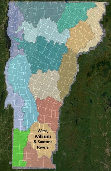
Every five years the state runs one of Vermont's 15 river basins through a plan like this one. This summer it's southern Vermont's turn — 263 pages on the West, Williams, and Saxtons rivers, more than 25 towns, one month to respond. Here's the handle: what it proposes for your town, and how to weigh in before July 15.
Every so often, the state sets a thick stack of paper on the public’s desk and asks what it thinks.
This summer’s stack is 263 pages — the draft Tactical Basin Plan for Basin 11, the state’s five-year roadmap for the rivers, lakes, and wetlands of southern Vermont’s West, Williams, and Saxtons watershed. It’s one of 15 basins the state maps and manages on a rolling schedule. Vermont runs a lot of water through this process: some 800 lakes, 23,000 miles of rivers, and 300,000 acres of wetland statewide, all of it eventually written up in a document like this one. Right now it’s the turn of the more than 25 towns that drain toward the Connecticut between Mount Holly and Brattleboro. Public comment closes July 15.
Here’s the thing about a stack like that. None of it is secret — it’s all public, all online, all technically yours. But “technically public” and “actually usable” are not the same thing. The information lands as a brick, the clock runs about a month, and the handful of decisions that touch your particular town are scattered across hundreds of pages written for engineers and regulators. Most people take one look and set it aside.
So here’s the handle — what’s actually in it, and what’s in it for where you live.
Inside are decisions that touch real ground. The plan recommends removing two dams on the West River system. It flags more than 20 clean streams for stronger legal protection. It names special stretches of water — a gorge, a falls, a cove — for the state’s highest safeguards. And it steers where a limited pot of state and federal money goes over the next five years, to fix eroding roads, build stormwater systems, and shore up failing septic. For all that, this isn’t a basin in trouble: most of its waters already test good to excellent. The plan is mostly about keeping them that way — and fixing the spots that aren’t.
What a “tactical basin plan” actually is
The name is dry, but the document isn’t just an environmental report that sits on a shelf. A basin plan does three things. It takes stock of how healthy the basin’s waters are. It lays out a list of priority actions — around 80 of them this round — for the next five years. And it points landowners, towns, and conservation groups toward the funding and technical help to carry those actions out. Much of the work depends on willing landowners, because so many of the streambanks and shorelines in question are private. That’s a big part of why the state wants public eyes on the draft now.
“It is critical that we hear from community members,” DEC Commissioner Misty Sinsigalli said in announcing the draft. The agency says it will use the feedback to make the plan fit local realities. Cory Ross, district manager of the Windham County Natural Resources Conservation District, called the plan a key tool for deciding which projects his district designs and builds — and for steering federal dollars toward local needs.
That’s the case for caring. Here’s the catch.
The part that’s hard to use
[Analysis]
The plan is 263 pages because it’s doing two jobs at once. It’s a federal compliance document, built to satisfy the Clean Water Act and the state rules that govern how Vermont protects water. And it’s a public document, meant for the people who live here. The first job wins. Roughly half the file is appendices — a report card, a dam inventory, a fisheries assessment, agency coordination agreements. The decisions a resident would actually want to weigh in on sit in a four-page summary and a single table, surrounded by hundreds of pages of material written for engineers and regulators.
So a homeowner in Londonderry who’d want to know the state is recommending a dam removal a few miles upstream, or a landowner near a stream that’s about to get a protection upgrade, has to know the document exists, find it, and then find themselves inside it. The comment window — 30 days, over a Vermont summer — assumes they’ll do all three.
There is a shorter way in — sort of. The state built a clickable Story Map to go with the plan, and as orientation it’s fine: it explains what a basin plan is, lays out the five-year cycle, and even names the two dams up for removal. What it won’t do is place any of it. It names the Williams and Weston Mill dams but not the towns they sit in. It shows the streams proposed for stronger protection as numbers keyed to a map, not names you’d recognize. It tells you what’s in the plan without telling you where you stand in it — and for that, you’re back in the 263-page PDF or clicking through a separate projects map.
This isn’t a knock on the people who wrote the plan; the science in it is serious and the work is real. It’s a knock on the format. A plan that depends on public participation shouldn’t make participation this much work.
So, in plainer terms, here’s what’s in it — and what’s in it for your town.
What’s actually being decided
The two most concrete proposals are dam removals. The plan recommends taking out the Williams Dam on the West River in Londonderry, with floodplain restoration above and below it, and the Weston Mill Dam in Weston, paired with replacing the Lawrence Hill Road bridge. Dam removals carry direct consequences for nearby property and roads, which makes them exactly the kind of thing residents tend to want a say in.
Beyond the dams, the plan flags more than 20 clean streams — among them Stickney Brook, Sacketts Brook, the Winhall River, and stretches of the Williams and West — for reclassification, a legal upgrade that locks in their current quality and makes future pollution harder to permit. It recommends naming several special places as Outstanding Resource Waters, including Brockways Mills Gorge and Herricks Cove in Rockingham, Twin Falls on the Saxtons in Westminster, and the Retreat Meadows in Brattleboro. And it puts three wetland complexes — at the Athens Dome, the Winhall River headwaters, and Eddy Brook — under study for Class I status, the strongest wetland protection the state offers.
The rest of the roughly 80 strategies cover the workaday business of clean water: streamside buffers, farm runoff, road and culvert fixes, ski-area stormwater, septic relocation, invasive-species patrols at boat launches.
Sidebar — The surprising source
Some of the nitrogen that washes off this basin travels all the way to Long Island Sound, where an overload of it feeds algae blooms that pull oxygen from the water and suffocate marine life. The state models where Basin 11’s share comes from, and the breakdown holds a quiet surprise.
By far the biggest source is the air itself: about 71 percent arrives as atmospheric fallout, much of it carried in on out-of-state air pollution and slowly declining under the federal Clean Air Act — not something any one Vermont town can fix. Among the local sources, runoff from developed land and roads leads at roughly 12 percent. But the next-largest is one most people would never guess: residential septic systems, at about 9 percent — ahead of agriculture’s 7 percent. Municipal sewage plants trail at just 1 percent.
The lesson for a rural watershed runs against the grain: the nitrogen that matters isn’t always the farm down the road. Sometimes it’s the tank in the backyard. It’s part of why the plan leans on homeowner septic workshops and on moving the most vulnerable systems out of the floodplain.
How to weigh in before July 15
Start with the short version. The state’s Story Map is the friendliest orientation, and the four-page summary at the front of the plan is the fastest read. The full draft and an interactive project map are on the Basin 11 webpage.
Send a comment by July 15 to watershed planner Marie Caduto: Marie.Caduto@vermont.gov or 802-490-6142.
Or show up. Both meetings start at 6:00 PM with a remote option (register ahead via this form):
Tuesday, June 23 — Newfane Town Office, 555 VT Route 30.
Thursday, June 25 — Londonderry Town Office, 100 Old School Street, South Londonderry.
You can also petition. Any resident can formally ask the state to reclassify a stream or lake, or to designate an Outstanding Resource Water — independent of this plan.
What’s proposed for your town
Every town in the basin is covered by the plan’s general strategies. These towns also have something specific on the table:
Andover — Asked to strengthen flood-hazard and river-corridor rules.
Athens — Athens Dome wetland complex (with Grafton) under study for top protection. Flood-rule ask.
Brattleboro — Connecticut River and Retreat Meadows recommended as Outstanding Resource Waters; stormwater focus; flood-rule ask.
Chester — Priority for fixing erosion-prone roads and culverts.
Dummerston — Jelly Mill Falls on Stickney Brook and the Rock River (with Newfane) recommended as Outstanding Resource Waters.
Grafton — Shares the Athens Dome wetland study. Flood-rule ask.
Jamaica — Forester Pond recommended as an Outstanding Resource Water; road-erosion priority; flood-rule ask.
Londonderry — Williams Dam removal on the West River; Lily Pond recommended as an Outstanding Resource Water. Hosts the June 25 meeting.
Marlboro — Road-erosion and culvert priority.
Mount Tabor — Flood-rule ask.
Newfane — Town stormwater plan to be completed; road-erosion priority; Adams Brook, Bemis Brook, and the Rock River recommended as Outstanding Resource Waters. Hosts the June 23 meeting.
Peru — Eddy Brook wetlands (with Winhall) under study for top protection. Flood-rule ask.
Putney — Road-erosion priority; new river-management plans for Sacketts Brook and East Putney Brook (shared with Westminster), both in line for stronger protection. Flood-rule ask.
Rockingham — The most on the table: Outstanding Resource Water recommendations at Brockways Mills Gorge, Herricks Cove, the Great Falls area, and the Williams River’s scenic reach — three already being pursued — plus stormwater cleanup in the industrial parks.
Stratton — Ski-area runoff a priority, including a cleanup plan for Ball Mountain Brook and the Winhall River. Flood-rule ask.
Townshend — Flood-rule ask.
Wardsboro — Town stormwater plan to be completed. Flood-rule ask.
Westminster — Twin Falls on the Saxtons River recommended as an Outstanding Resource Water; new river-management plans for Sacketts and East Putney Brooks (shared with Putney).
Weston — Weston Mill Dam removal and Lawrence Hill Road bridge replacement.
Winhall — Winhall River headwaters and Eddy Brook wetlands under study for top protection; ski-area runoff a priority; the plan flags Bromley Resort’s snowmaking withdrawals from Mill Brook. Flood-rule ask.
Other towns — including Brookline, Dover, Landgrove, and Windham — sit in the basin and are covered by the general strategies without a town-specific item in the draft.
Compass Vermont will keep following Basin 11 through the comment period and beyond. If you live in one of these towns and you have a stake in what the plan proposes — a stream behind your house, a dam down the road, a wetland you’ve watched for years — we want to hear from you. Reach out at news@compassvermont.com and tell us what the state’s plan looks like from where you stand.