

Stowe Rescue: Skier Follows Old Social Media Map, Ends Up on Icy Cliff—Climbs 700' Out Before Help Arrives
"We stand by our assertion that the only way to learn backcountry ski lines is to go with someone who knows the terrain." Stowe Mountain Rescue

Last winter a map was published on social media of backcountry ski lines in the Stowe area. The map was a tantalizing prospect for those who love to ski the backcountry.
At the time, Stowe Mountain Rescue requested that it be taken down as we were concerned about a potential uptick in backcountry rescues. Call us the Fun Police, but sometimes a little information can be a dangerous thing, and it seemed like a well-intentioned gesture that had the potential to backfire.
Yesterday we were called out to assist a backcountry skier who was going after a line he had seen on that same map.
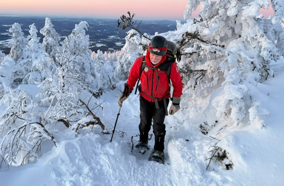
Not knowing the terrain well, he took the wrong chute and it could have cost him his life. He found himself above an icy cliff band and had no option but to climb 700 vertical feet back up the gulley.
It was dangerous, exhausting and time-consuming and he lost a ski and a pole in the process. Even once he had regained the ridge, he was facing a long retreat that he was utterly unprepared for, in terms of both time and equipment.
We were able to assist by intersecting his route and delivering snowshoes, food, water, warm gloves and a ride down the mountain after dark by snowcat, courtesy of Stowe Mountain Resort.
We stand by our assertion that the only way to learn backcountry ski lines is to go with someone who knows the terrain. Learn where to go firsthand, from a guide if necessary.
The terrain in Smugglers Notch is way too dangerous to risk route-finding mistakes. And when you’re skiing in the backcountry, always have a ski buddy and a plan B in mind – if you can’t achieve your intended route, where is your exit ramp and how long will it take? Then carry all the equipment you need to execute your mission safely.