

Lawmakers Reject Wetland Rule, Saying Agency Cannot Weigh Housing Against Wetland Protection
The Vermont Agency of Natural Resources testified that "the promotion of housing does not directly support the State policy to increase wetlands acreage through regulation and management..."

ANALYSIS | The Legislative Committee on Administrative Rules formally objected on Thursday to the Scott Administration’s proposed wetland rule — the regulatory vehicle for the housing piece of Executive Order 06-25. The objection prevents the Agency of Natural Resources from adopting the rule until the agency responds, at least for now.
Early coverage has framed the objection as a political defeat for the Governor’s housing agenda. That framing is accurate but incomplete. The substance of the objection — what the committee actually said in its memo to the Agency of Natural Resources — is a more pointed answer to a more fundamental question: who in Vermont gets to decide whether housing is worth the cost of weaker wetland protections?
The committee’s answer: not the agency.
The question the rule put on the table
The Administration’s filing and the state’s 2025 Housing Needs Assessment describe a substantial housing shortage. The Department of Environmental Conservation’s final April filing cites estimates that Vermont needs 24,000 to 36,000 additional housing units over the next several years to meet demand. According to the filing, about half of Vermont renters spend an unacceptable portion of their income on housing, and roughly 25 percent spend more than half their income on housing costs.
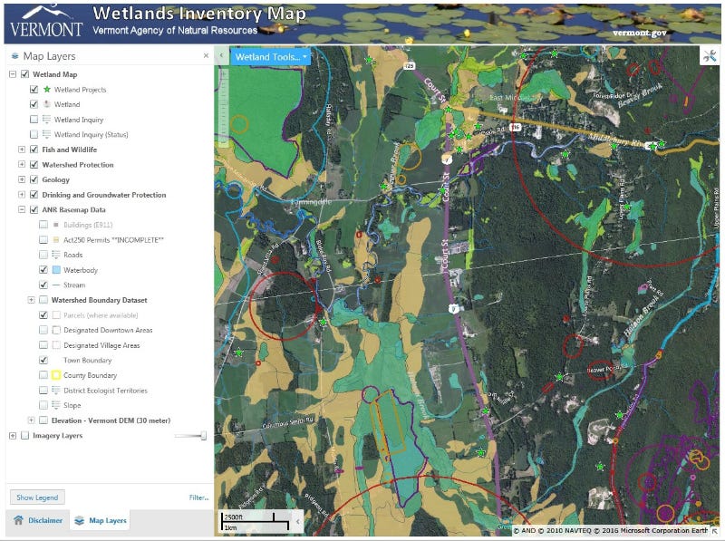
Executive Order 06-25, issued by Governor Scott on September 17, 2025, directed several state agencies to identify regulatory changes that could accelerate housing construction. The wetland piece — Rule 25P040 — was the resulting proposal from ANR and DEC. It would have created a new “allowed use” exempting residential housing projects from wetland permitting in three categories of designated growth areas: downtowns, village centers, and zones served by municipal water and sewer.
The geographic scope was narrow but layered. According to DEC’s filing, the designated growth areas total 198,945 acres — about 3 percent of Vermont. Mapped wetlands inside those areas account for about 6 percent of that 3 percent, or roughly 0.18 percent of the state’s total land area. The rule would not have permitted direct construction inside those mapped wetland cores. Instead, it would have done two things: allowed residential construction in unmapped Class II wetlands within designated areas without a wetland permit, and reduced the protected buffer around mapped Class II wetlands from 50 feet to 25 feet.
The rule was also designed to expire. All registrations under the allowed use would have to be submitted by January 1, 2030, with construction starting by September 2030 and final stabilization by December 2031. DEC stated in its filing that the sunset was set, in the agency’s own words, “consistent with the sunset dates approved by the Vermont Senate in March of 2026 under Bill S.325” — the Senate’s bill extending several Act 181 implementation deadlines.
In other words, the Administration’s proposal was: accept a narrow, time-limited reduction in wetland protections in a small slice of the state, in exchange for faster housing construction in the places Vermont has already designated for growth. A tradeoff. A balancing act.
The committee’s objection was to the act of balancing itself.
What the committee actually said
The committee’s memo, signed by Chair Rep. Trevor Squirrell, raised three distinct legal objections to Section 6.26 and Appendix B of the proposed rule.
The most fundamental came in Section I. Vermont law, 10 V.S.A. § 901, establishes the state’s wetlands policy: net gain of wetland acreage, regulation guided by science, authorized activities producing a net environmental benefit. Act 121 of 2024 — the Flood Safety Act, the Legislature’s response to the catastrophic 2023 and 2024 floods — reinforced that direction at 10 V.S.A. § 918, stating that “the goal of wetlands regulation and management in the State is the net gain of wetlands.” The same Act established a 2:1 compensatory mitigation ratio: any permitted, permanent wetland loss above 5,000 square feet must be offset by the restoration or creation of twice that acreage elsewhere.
The committee’s reading: the General Assembly has already made the policy choice. Wetlands are protected. The Legislature set the baseline, and reserved the authority to change it to itself. The agency’s job is to implement that protection, not to revisit it.
The memo’s key passage, in the committee’s own words:
“Neither 10 V.S.A. chapter 37 nor the Commissioner’s discretion permits the Agency to disregard the General Assembly’s intent to protect wetlands in order to weigh the benefit of wetlands versus the economic cost in preserving the wetlands or potential economic benefits of removing wetlands to construct housing or other uses.”
In ordinary language, the committee’s position is that the agency is not permitted to balance housing against wetland protection through this rulemaking. The Legislature already did that balancing. The Administration can disagree with the result, but in the committee’s view it cannot use rulemaking to make a different choice.
DEC’s filing makes the opposite case. The agency argues that Vermont currently exceeds its net-gain goal “10- to 100-fold most years” through voluntary restoration, and that permitted activities statewide caused less than one acre of wetland loss in 2024 against 135 acres of voluntary gain. The agency’s argument: the state has so much wetland-restoration headroom that allowing modest loss in narrow growth areas does not undermine the statutory net-gain goal. There is a relevant nuance here. The proposed rule kept the 2:1 mitigation requirement intact for the individual-permit track, but it exempted the new “allowed use” track from any compensation requirement — meaning projects qualifying for the allowed use would have escaped offsetting altogether. That structural design is what the committee’s first objection was responding to.
The two other objections
The committee raised two additional grounds.
Section II — exceeds statutory authority. Under 10 V.S.A. § 902(9), the buffer around a Class II wetland is 50 feet unless the Secretary determines otherwise under § 914. The committee’s reading: § 914 requires those determinations to be individualized, made wetland by wetland. The proposed rule would have categorically reclassified the outer 25 feet of the buffer as an “allowed use,” effectively halving the protected buffer across all designated growth areas. The committee called this approach, in its own words, “a legal fiction intended to circumvent statutory requirements for how the Department is authorized to adjust the buffer width of specific, individual wetlands.”
This conclusion tracks Attorney General Charity Clark’s November formal opinion, which found that the Governor could not shrink the buffer to 25 feet by executive order alone. The committee explicitly cited and agreed with Clark’s reasoning.
Section III — arbitrary. Under 3 V.S.A. § 801(13), a rule is arbitrary when it lacks factual basis or would not make sense to a reasonable person. The proposed rule asked builders to rely on the Vermont Significant Wetlands Inventory maps as a binding legal boundary — drawing a 25-foot setback from the mapped edge.
But the existing Vermont Wetland Rules — currently in force, written by the same agency — explicitly disclaim the maps for that purpose. Section 3.2(b) states that VSWI maps “denote the approximate location and configuration of significant wetlands. The actual boundaries... shall be determined in the field.” Section 4.4 adds that the maps “should not be relied upon to provide precise information regarding the location or configuration of wetlands.” DEC’s Wetland Maps webpage states the same thing in plainer language: “Only a qualified wetland scientist may determine the absence or presence of a wetland and its boundaries.”
The committee’s conclusion, in its own words: “the proposed Rules rely on maps that the proposed Rules deem unreliable without individualized determination in the field, the proposed Rules lack a factual basis to support the proposed change and would not make sense to a reasonable person.”
The memo flagged a related procedural gap. The rule allows linear utilities — sewer laterals, water lines, electric, gas, communications — to cross mapped wetlands under certain conditions, but does not specify how a builder is supposed to demonstrate that those conditions have been met.
How wetlands are actually identified
The map-versus-fieldwork distinction at the heart of the third objection is worth understanding, because it shapes what any future rule on this subject will have to grapple with.
Vermont uses the federal standard — the 1987 U.S. Army Corps of Engineers Wetland Delineation Manual — for identifying wetlands. Under that methodology, a qualified wetland scientist visits the site and documents three things at the same place: water-loving plants, soils that show physical signs of long saturation, and a water table close enough to the surface for enough of the growing season. All three must be present. The scientist walks the edge and marks the boundary based on where the indicators stop.
Even formal federal wetland determinations expire after five years because conditions shift — climate, beaver activity, drainage, plant succession. Vermont’s existing wetland rules state directly that “wetland characteristics and boundaries are not static.”
Under the existing rules, the maps function as screening tools, not legal boundaries.
The mapping overhaul already in progress
One piece of context the LCAR memo does not dwell on but that shapes the timeline going forward: Vermont’s wetland maps are already being rebuilt.
The 2024 Flood Safety Act requires the Agency of Natural Resources to complete an entirely new, higher-quality wetland inventory — using the federal National Wetlands Inventory Plus standard with field ground-truthing — for every tactical basin in the state by January 1, 2030. The University of Vermont’s Spatial Analysis Lab and Saint Mary’s University of Minnesota are doing the mapping work, accelerated in 2022 by a $250,000 state one-time appropriation, according to DEC’s response to public comments.
In that response, DEC says improved maps are “currently available for roughly 80% of the state and will be available before the end of 2026 for remaining areas.” That timeline could matter for future rulemaking, because more accurate maps may reduce — though not eliminate — the force of objections based solely on map imprecision. The new maps do not solve the underlying methodological reality that wetland boundaries still require field determination.
The first and second objections are different. Both rest on LCAR’s reading of statutory limits, rather than on map quality. If that reading is correct, a change in the statutory balance would need to come from the Legislature, not from agency rulemaking.
What happens next
Under 3 V.S.A. § 842(a), ANR has 14 days from receipt of the objection — until June 4 — to respond. Until it does, the rule cannot be adopted. After receiving the response, LCAR may withdraw its objection, modify it, or maintain it. After responding, the Administration may still seek to proceed over the objection, but doing so would leave the rule vulnerable to legal challenge — a risk the Attorney General flagged in November for builders and homeowners who would have to rely on a rule that, in her view, exceeds statutory authority.
The broader question the committee put on the table does not get resolved by the 14-day cycle, or by the next legislative session. Vermont’s housing shortage is likely to persist. The pressure to find regulatory paths to faster construction is likely to persist with it. Future rules from future administrations are likely to test the same question this rule tested.
LCAR’s objection asserts that agencies cannot weigh housing against wetland protection on their own initiative when doing so conflicts with the wetland-protection policy the Legislature has written into statute. The Legislature can choose to revisit the balance — by amending 10 V.S.A. § 901, § 902(9), § 914, or § 918 — but until it does, the policy choice already on the books stands.
Whether that choice is the right one — whether Vermont’s interest in protecting wetlands on a small fraction of designated growth areas outweighs the housing need the Administration is trying to address — is not a question the law answers. It is a question Vermonters, through their elected representatives, get to answer.
This week, that question is back on their desks.
Would a reasonable person want to (risk) build their house on land that is a wetland or has not been determined not to be a wetland? "Rivers remember. They remember their many homes, every single one they had breathed in before, thrived in..." - Is A River Alive? Robert Macfarlane.
Let's float Boats, Not Houses - Bernie