

How Did New Haven Get So Far Away From Fair and West Haven?
How Vermont's Geography Reveals Separate Pasts
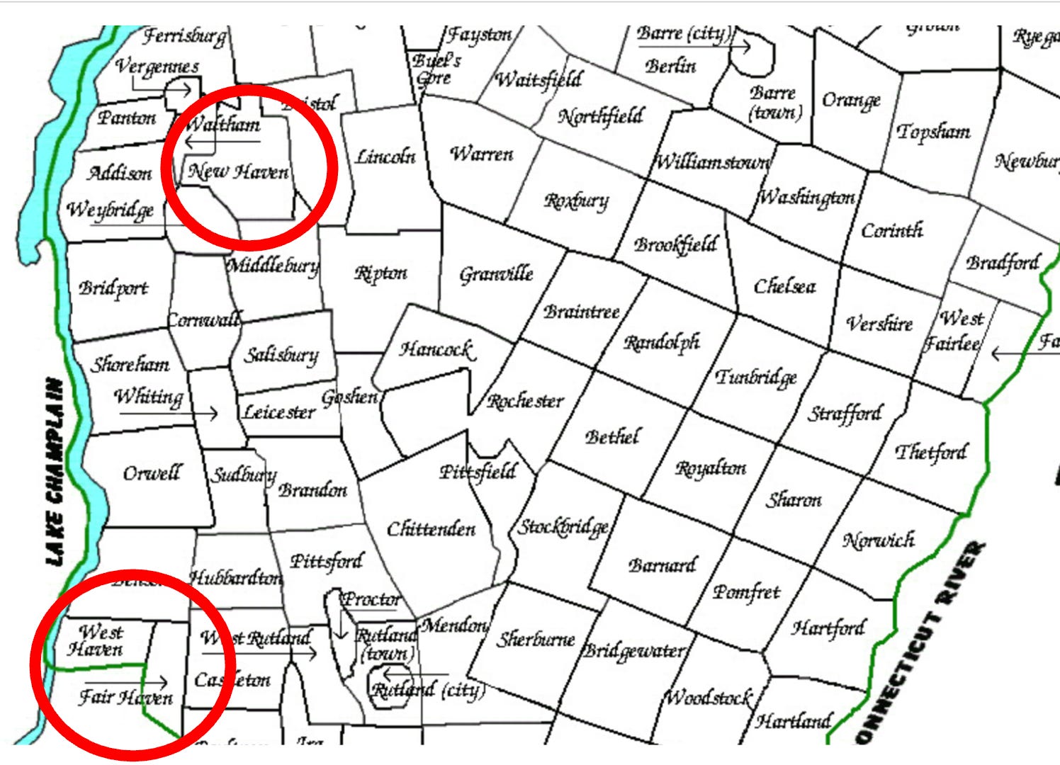
Any Vermonter with a well-worn road atlas has likely pondered the question: Why is New Haven in Addison County, a full 40 miles north of its namesakes, Fair Haven and West Haven, which sit cozily next to each other on the New York border? While it’s easy to assume a shared lineage, the answer lies not in a single story, but in two very different histories—one of colonial homage and another of classic Vermont pragmatism. The geographical separation is no accident, but a direct reflection of their distinct and unrelated foundings.
New Haven: A Connecticut Heritage Transplanted
The story of New Haven begins with a common 18th-century settlement practice. According to the official town charter, granted by New Hampshire Governor Benning Wentworth on November 2, 1761, the town’s original proprietors were largely from Salisbury, Connecticut, and the surrounding area. Further historical accounts compiled by the University of Vermont's PLACE Program confirm that these settlers named their new township after the prominent Connecticut coastal city of New Haven, carrying a piece of their heritage to a new frontier. Its location in Addison County was simply where their grant was located, with no connection to the future towns in Rutland County.
Fair Haven & West Haven: A Shared and Severed Past
In stark contrast, the history of Fair Haven and West Haven is one of shared origin and subsequent, deliberate division. The original, unified town of Fair Haven was chartered on October 27, 1779. While its name suggests a pleasant location, the exact reason for it is surprisingly elusive. As author Andrew N. Adams notes in his definitive 1870 text, "A History of the town of Fair Haven, Vermont," the precise origin of the name remains uncertain, a small mystery lost to time. What is clear, however, is that this single town would not remain unified for long.
A Town Divided by Geography and Ambition
The reasons for the split are explicitly laid out in a petition filed with the Vermont General Assembly, which led to the official incorporation of West Haven on October 20, 1792. The petitioners from the western part of town cited several practical grievances. Chief among them, according to the petition, was the "Great Ledge," a significant rock ridge that created a natural and formidable barrier, making the trip to the town center in the east difficult. The document also points to diverging economies: the west possessed superior farmland, while the eastern section, with its powerful waterfalls on the Castleton River, was developing under the leadership of Colonel Matthew Lyon into a hub for industry, including various mills and forges.
The Story Told by Data and Maps
An analysis of early U.S. Census data for Vermont powerfully illustrates the impact of this division. In 1790, the unified Fair Haven had 545 residents. By the 1800 census, taken after the split, Fair Haven’s population was 411, while the newly formed West Haven already had 430 residents, underscoring the substantial community that had successfully argued for its own municipal identity. This history is further borne out by cartographic evidence. Maps from the period, such as a 1794 plan of Rutland County, provide a clear visual record of the new town line drawn just two years after the legislature approved the separation.
Two Paths, One Name
Ultimately, the case of Vermont's "Haven" towns serves as a perfect illustration of the state's settlement patterns. The assumption of a shared origin, while logical on its face, is debunked by a history of two separate movements: one of colonists looking to honor their past by transplanting a name, and another of residents looking to forge a new future by dividing a town that no longer served all its people. The 40-mile gap between them isn't an error, but a story written on the landscape of Vermont itself.